Category:Great Casterton
Jump to navigation
Jump to search
village in Rutland, England, UK  | |||||
| Upload media | |||||
| Instance of | |||||
|---|---|---|---|---|---|
| Location | Rutland, East Midlands, England | ||||
| Area |
| ||||
 | |||||
English: Great Casterton is a village in the county of Rutland in the East Midlands of England. It is located at the crossing of the Roman Ermine Street and the River Gwash.
Italiano: Great Casterton è un villaggio della contea inglese di Rutland, nelle Midlands Orientali, ubicata all'incrocio della romana Ermine Street e del fiume Gwash. Si trova a circa tre miglia a nord-ovest di Stamford nel Lincolnshire e davvero molto vicina al confine col Lincolnshire (South Kesteven).
Subcategories
This category has the following 2 subcategories, out of 2 total.
G
- Great Casterton Road Banks (5 F)
Media in category "Great Casterton"
The following 166 files are in this category, out of 166 total.
-
 A1 - crossing the B1081 - geograph.org.uk - 2643734.jpg 640 × 428; 76 KB
-

-
 Afternoon sunshine on the church in Great Casterton - geograph.org.uk - 6306973.jpg 4,032 × 3,024; 2.42 MB
-

-
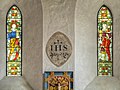
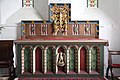
 Altar, Great Casterton Church - geograph.org.uk - 4116067.jpg 640 × 480; 291 KB
-
 An escapee from Woodhead^ - geograph.org.uk - 3086105.jpg 1,024 × 768; 196 KB
-
 Arable land - geograph.org.uk - 3576015.jpg 1,024 × 680; 265 KB
-
 Arable land field headland - geograph.org.uk - 3576010.jpg 1,024 × 680; 230 KB
-

-
-
 Bridge Farmhouse, Great Casterton (geograph 6364943).jpg 1,024 × 715; 130 KB
-

-

-
 Casterton College Rutland - geograph.org.uk - 6116925.jpg 1,920 × 1,280; 1.75 MB
-
 Casterton College Rutland - geograph.org.uk - 6116927.jpg 1,876 × 1,212; 1.22 MB
-

-
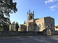
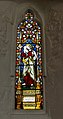
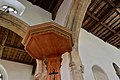
 Church of St Peter and St Paul, Great Casterton - geograph.org.uk - 5655073.jpg 3,541 × 2,363; 1.65 MB
-

-
 Dog Skull Roman.JPG 1,280 × 960; 652 KB
-
 Dry Stone Wall - geograph.org.uk - 1058348.jpg 640 × 427; 81 KB
-
 East Wood from the road - geograph.org.uk - 350838.jpg 640 × 480; 119 KB
-
 Elizabeth II Postbox, Great Casterton - geograph.org.uk - 6018873.jpg 683 × 1,024; 210 KB
-
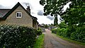
 Entering Great Casterton - geograph.org.uk - 3089654.jpg 800 × 600; 226 KB
-
 Entrance to Great Casterton - geograph.org.uk - 3350318.jpg 640 × 455; 64 KB
-

-

-
 Ermine Rise, Great Casterton - geograph.org.uk - 3085059.jpg 1,024 × 768; 116 KB
-
 Even road try to avoid this square - geograph.org.uk - 350836.jpg 640 × 480; 144 KB
-
 Farmland at the edge of Great Casterton (1) - geograph.org.uk - 3085067.jpg 1,024 × 768; 202 KB
-
 Farmland at the edge of Great Casterton (2) - geograph.org.uk - 3085071.jpg 1,024 × 768; 175 KB
-
 Farmland in Great Casterton - geograph.org.uk - 6306945.jpg 4,032 × 3,024; 5.4 MB
-
 Farmland near Great Casterton - geograph.org.uk - 1834700.jpg 3,648 × 2,736; 2.03 MB
-
 Farmland near Great Casterton - geograph.org.uk - 3576901.jpg 1,024 × 680; 227 KB
-
 Farmland near Great Casterton - geograph.org.uk - 4472942.jpg 4,320 × 3,240; 5.61 MB
-
 Farmland south of Pickworth - geograph.org.uk - 6211916.jpg 3,776 × 2,520; 3.89 MB
-
 Field east of Pickworth Road - geograph.org.uk - 6210936.jpg 3,776 × 2,520; 3.94 MB
-
 Field entrance with a warning, Pickworth Road - geograph.org.uk - 3086020.jpg 1,024 × 768; 139 KB
-
 Field of cereal on Ryhall Road, Great Casterton - geograph.org.uk - 4472928.jpg 4,320 × 3,240; 5.73 MB
-
 Footpath approaching Pickworth Road - geograph.org.uk - 5670496.jpg 3,776 × 2,520; 3.74 MB
-
 Footpath east of Taylor's Farm near Pickworth - geograph.org.uk - 4474033.jpg 4,320 × 3,240; 5.52 MB
-
 Footpath from Taylor's Farm - geograph.org.uk - 350845.jpg 640 × 480; 127 KB
-
 Footpath near Frith Farm, north of Tolethorpe Hall - geograph.org.uk - 4473222.jpg 4,320 × 3,240; 6.09 MB
-
 Gate near East Wood - geograph.org.uk - 4473996.jpg 4,320 × 3,240; 5.46 MB
-
 Gated track near Woodhead - geograph.org.uk - 3086055.jpg 1,024 × 768; 226 KB
-
 Great Casterton church - geograph.org.uk - 3576916.jpg 1,024 × 680; 195 KB
-
 Great Casterton Church and War Memorial - geograph.org.uk - 4116054.jpg 640 × 480; 314 KB
-

-
 Great Casterton farmland - geograph.org.uk - 1058365.jpg 640 × 427; 95 KB
-
 Great Casterton Roman Town - geograph.org.uk - 132451.jpg 640 × 427; 75 KB
-
-

-

-
 Great Casterton, The church of St. Peter and St. Paul - geograph.org.uk - 4499059.jpg 3,627 × 2,373; 4.56 MB
-
 Great Casterton, The church of St. Peter and St. Paul - geograph.org.uk - 4499062.jpg 3,678 × 2,456; 4.51 MB
-
 Great Casterton, The church of St. Peter and St. Paul - geograph.org.uk - 4499074.jpg 3,640 × 2,391; 4.28 MB
-
 Great Casterton, The church of St. Peter and St. Paul - geograph.org.uk - 4499077.jpg 3,678 × 2,456; 5.48 MB
-

-

-

-

-

-

-

-

-

-

-
-

-

-

-

-

-
-

-

-

-

-

-

-
 Great Casterton, The entrance to Church Farm - geograph.org.uk - 4499067.jpg 4,724 × 2,667; 7.1 MB
-
 Great North Road - geograph.org.uk - 3350319.jpg 640 × 477; 53 KB
-
 Hay field on the north side of the Gwash valley - geograph.org.uk - 3085695.jpg 1,024 × 768; 146 KB
-
 Haymaker at work, north of Great Casterton - geograph.org.uk - 3085708.jpg 1,024 × 768; 142 KB
-
 Haymaking north of Great Casterton - geograph.org.uk - 3085700.jpg 1,024 × 768; 174 KB
-

-
 Near the Crown in Great Casterton - geograph.org.uk - 6306961.jpg 4,032 × 3,024; 4.75 MB
-
 Newly surfaced path past new plantation on Walk Farm - geograph.org.uk - 5670469.jpg 3,776 × 2,520; 3.08 MB
-
 No sign of the bull - geograph.org.uk - 3086027.jpg 1,024 × 768; 171 KB
-
 Old Great North Road at Great Casterton - geograph.org.uk - 4115968.jpg 640 × 480; 346 KB
-

-
 Old Great North Road through Great Casterton - geograph.org.uk - 5655081.jpg 3,776 × 2,520; 3.51 MB
-
 Old Great North Road, Great Casterton - geograph.org.uk - 2917960.jpg 795 × 584; 116 KB
-
 Old Great North Road, Great Casterton - geograph.org.uk - 3085053.jpg 1,024 × 768; 117 KB
-
 Old Great North Road, Great Casterton - geograph.org.uk - 6111847.jpg 1,920 × 1,280; 1.26 MB
-
 Old Great North Road, Great Casterton - geograph.org.uk - 6116908.jpg 1,920 × 1,280; 1.13 MB
-
 Old Great North Road, Great Casterton - geograph.org.uk - 6184612.jpg 1,880 × 1,218; 1.37 MB
-
 Overgrown pillbox and footpath off Ryhall Road - geograph.org.uk - 4473074.jpg 4,320 × 3,240; 5.68 MB
-
 Pasture field north-east of Woodhead - geograph.org.uk - 3086068.jpg 1,024 × 768; 197 KB
-
 Pickworth Road (1) - geograph.org.uk - 3085776.jpg 1,024 × 768; 162 KB
-
 Pickworth Road (1) - geograph.org.uk - 3086045.jpg 1,024 × 768; 159 KB
-
 Pickworth Road (2) - geograph.org.uk - 3086031.jpg 1,024 × 768; 179 KB
-
 Pickworth Road (2) - geograph.org.uk - 3086075.jpg 1,024 × 768; 188 KB
-
 Pickworth Road at the 66 metre spot height - geograph.org.uk - 3086082.jpg 1,024 × 768; 178 KB
-
 Pickworth Road midway between Great Casterton and Pickworth - geograph.org.uk - 6211933.jpg 3,776 × 2,520; 4.07 MB
-
 Pickworth Road north from Great Casterton - geograph.org.uk - 6210920.jpg 3,776 × 2,520; 4.12 MB
-
 Pickworth Road, heading to Great Casterton - geograph.org.uk - 3085760.jpg 1,024 × 768; 126 KB
-
 Rapeseed crop near Taylor's Farm - geograph.org.uk - 4474022.jpg 4,320 × 3,240; 5.6 MB
-
 Ready for baling - geograph.org.uk - 3085692.jpg 1,024 × 768; 150 KB
-
 River Gwash passes beneath the A1 - geograph.org.uk - 3350320.jpg 640 × 461; 59 KB
-
 Roman Dog Skull.JPG 1,280 × 960; 610 KB
-
 Rutland Road - geograph.org.uk - 1058353.jpg 640 × 427; 78 KB
-
 Rutland Road farm buildings - geograph.org.uk - 1058341.jpg 640 × 427; 56 KB
-
 Ryhall Road - geograph.org.uk - 3085676.jpg 1,024 × 768; 186 KB
-
 Ryhall Road - geograph.org.uk - 6118095.jpg 1,775 × 1,083; 877 KB
-
 Ryhall Road towards Great Casterton - geograph.org.uk - 4211102.jpg 640 × 480; 283 KB
-
 Ryhall Road, Great Casterton - geograph.org.uk - 6184623.jpg 1,920 × 1,280; 933 KB
-
 Shades of green near Woodhead - geograph.org.uk - 3086098.jpg 1,024 × 768; 231 KB
-
 St Peter and St Paul's Church - geograph.org.uk - 4686247.jpg 1,024 × 683; 122 KB
-
 St Peter ^ St Paul's, Great Casterton - geograph.org.uk - 3089663.jpg 800 × 600; 300 KB
-
-
-

-
 St Peter ^ St Paul, Great Casterton - geograph.org.uk - 4470373.jpg 900 × 600; 298 KB
-
 St Peter ^ St Paul, Great Casterton - geograph.org.uk - 4470375.jpg 900 × 568; 201 KB
-

-

-
-

-

-

-
 Stamford Osteopathic Clinic, Great Casterton - geograph.org.uk - 6018878.jpg 1,024 × 683; 197 KB
-
 Stamford Veterinary Centre, Great Casterton - geograph.org.uk - 6018883.jpg 1,024 × 683; 223 KB
-
 Stubble field in partial sunlight - geograph.org.uk - 3085747.jpg 1,024 × 768; 158 KB
-

-
 The Crown - geograph.org.uk - 599981.jpg 640 × 427; 52 KB
-
 The Crown, Great Casterton - geograph.org.uk - 3576923.jpg 1,024 × 680; 155 KB
-
 The Crown, Great Casterton - geograph.org.uk - 4116077.jpg 640 × 480; 303 KB
-
 The Danelaw Way crossing a small valley on Walk Farm - geograph.org.uk - 5670474.jpg 3,776 × 2,520; 3.02 MB
-
 The north-west corner of Exeter Gorse - geograph.org.uk - 3090238.jpg 1,024 × 768; 186 KB
-
 The northern edge of Exeter Gorse - geograph.org.uk - 3090243.jpg 1,024 × 768; 191 KB
-
 The Old Great North Road, Great Casterton - geograph.org.uk - 3576951.jpg 1,024 × 680; 172 KB
-
 The Old Rectory Great Casterton.jpg 1,500 × 889; 417 KB
-

-

-

-
 The War Memorial at Great Casterton - geograph.org.uk - 3089668.jpg 800 × 600; 338 KB
-
 The War Memorial at Great Casterton - geograph.org.uk - 3089679.jpg 600 × 800; 274 KB
-
 The War Memorial at Great Casterton - geograph.org.uk - 3089684.jpg 600 × 800; 321 KB
-
 Track leading to Exeter Gorse - geograph.org.uk - 6211924.jpg 3,776 × 2,520; 3.91 MB
-
 Track leading west from Mounts Lodge farm. - geograph.org.uk - 6210946.jpg 3,776 × 2,520; 4.22 MB
-
 Track near Tickencote Warren - geograph.org.uk - 476466.jpg 640 × 480; 67 KB
-
 Track on south side of stubble field - geograph.org.uk - 3085751.jpg 1,024 × 768; 161 KB
-
 Track to Walk Farm - geograph.org.uk - 5670484.jpg 3,776 × 2,520; 3.54 MB
-
 Traffic management on the Old Great North Road - geograph.org.uk - 3085063.jpg 1,024 × 768; 143 KB
-
 Travellers Rest - geograph.org.uk - 3352710.jpg 3,040 × 2,282; 1.5 MB
-
 Uncultivated field margin - geograph.org.uk - 3085769.jpg 1,024 × 768; 196 KB
-
 View to Mounts Lodge - geograph.org.uk - 1058369.jpg 640 × 427; 50 KB
-
 War Memorial Detail (Left) - geograph.org.uk - 4116041.jpg 640 × 480; 365 KB
-
 War Memorial Detail (right) - geograph.org.uk - 4116044.jpg 640 × 480; 375 KB
-
 Water Lane - geograph.org.uk - 5510476.jpg 640 × 480; 92 KB
-
 Wheatfield west of Pickworth Road - geograph.org.uk - 3086060.jpg 1,024 × 768; 185 KB
-
 Wild flowers on the west side of Pickworth Road - geograph.org.uk - 3085742.jpg 1,024 × 768; 154 KB
-
 Young tree plantation near Rob Hall Farm - geograph.org.uk - 4473073.jpg 4,320 × 3,240; 5.96 MB
-
 Bridleway from Mounts Lodge - geograph.org.uk - 350850.jpg 640 × 480; 142 KB
-
-
 The Great North Road, Great Casterton - geograph.org.uk - 63980.jpg 640 × 427; 68 KB


_north_of_Stamford,_aerial_2014_-_geograph.org.uk_-_4055408.jpg)


.jpg)


_-_geograph.org.uk_-_3085067.jpg)
_-_geograph.org.uk_-_3085071.jpg)


_-_geograph.org.uk_-_4116064.jpg)


_-_geograph.org.uk_-_4683280.jpg)


_-_geograph.org.uk_-_3085776.jpg)
_-_geograph.org.uk_-_3086045.jpg)
_-_geograph.org.uk_-_3086031.jpg)
_-_geograph.org.uk_-_3086075.jpg)


_-_geograph.org.uk_-_4116041.jpg)
_-_geograph.org.uk_-_4116044.jpg)


